|
| *****SWAAG_ID***** | 595 |
| Date Entered | 22/08/2012 |
| Updated on | 01/09/2012 |
| Recorded by | Tim Laurie |
| Category | Settlement |
| Record Type | Archaeology |
| SWAAG Site | Grinton Pastures |
| Site Access | Public Footpath |
| Record Date | 01/01/2005 |
| Location | Grinton Pastures. Dyke House Close. |
| Civil Parish | Grinton |
| Brit. National Grid | SE 036 982 |
| Geology | Till over the Middle Limestone. |
| Record Name | Settlement at Dykehouse Close cut by the western of the two Grinton-Fremington Dykes. |
| Record Description | See EDM Survey as Swaledale Land Boundaries Project Interim Report No 10, Figure 1 (1993 Season)and the OS High Level Aerial Photo extracts as attached.
North facing hill slope settlement with rectangular buildings of medieval character (A,B and C on the plan)and a probable Late Roman Farmstead Settlement with house platforms and rectangular yards similar to the settlement, Site 103, excavated by SWAAG at the Hag, Fremington below.
Long field banks descend the slopes from this RB Settlement.
The Linear Dyke certainly slights the settlement and field system and must therefor post date this site. |
| Dimensions | See plan |
| Image 1 ID | 3256 Click image to enlarge |
| Image 1 Description | Settlement at Dyke House Close cut by the western dyke as SWALB EDM Survey as SWALB Interim Rpt No 10, 1993 | 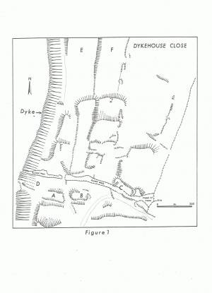 |
| Image 2 ID | 3257 Click image to enlarge |
| Image 2 Description | High Level Photograph of the Grinton Pastures, the Dykes and Settlements. | 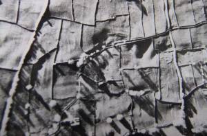 |
| Image 3 ID | 3258 Click image to enlarge |
| Image 3 Description | High Level Photograph of the Grinton Pastures, the Dykes and Settlements. | 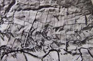 |
| Image 4 ID | 3259 Click image to enlarge |
| Image 4 Description | High Level Photograph of the Grinton Pastures, the Dykes and Settlements. | 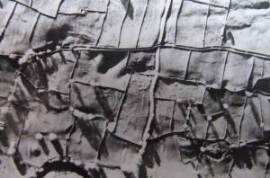 |
| Image 5 ID | 3260 Click image to enlarge |
| Image 5 Description | High Level Photograph of the Grinton Pastures, the Dykes and Settlements. | 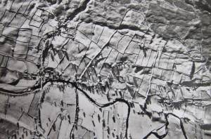 |


